


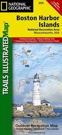
National Geographic's Trails IllustratedMaps are the most detailed and up-to-date topographic recreation maps available for US National Parks, National Forests and other popular outdoor recreation areas.
A necessity for exploring the outdoors, each map is printed on waterproof, tear-resistant material.
They also contain key safety and contact information, GPS and compass coordinates, Leave No Trace ethical guidelines and hundreds of points-of-interest, including scenic viewpoints, campgrounds, boat launches, swimming areas, marine sanctuaries and wildlife refuges.


![Raymarine Axiom Pro 16 S Chartplotter/Fishfinder [E70483]](https://www.outllandgear.shop/image/raymarine-axiom-pro-16-s-chartplotterfishfinder-e70483_kVGpDQ_300x.webp "Raymarine Axiom Pro 16 S Chartplotter/Fishfinder [E70483]")


![Coleman 6-Person Skydome Camping Tent - Blue Nights [2157690]](https://www.outllandgear.shop/image/coleman-6-person-skydome-camping-tent-blue-nights-2157690_rdWfFZ_300x.webp "Coleman 6-Person Skydome Camping Tent - Blue Nights [2157690]")

